Word Backup

A little bit of history (Word 5.1 1992)

With Microsoft Word 5 there was a small little option that allows you to tell Word to save every open document at a regular time interval (15 minutes for example). How this functionality was implemented was trivial. It only performed a regular “Save” or “Save As…” at the parameterized time interval. This worked nicely and everything was in order.

With such an implementation two goals where reached:

  • If the Word crashed, you will have, in the worst case, lost 15 minutes of work
  • If you made a mistake and forget to save your work, you will have, in the worst case, lost 15 minutes of work

Current time (Word 2008)

Somewhere in-between Word 5.1 and Word 2008 (I cannot say more precisely, because here, at home, we had such an upgrade path), this functionality didn’t disappear but the implementation changed. Now this functionality has been splited in two parts.

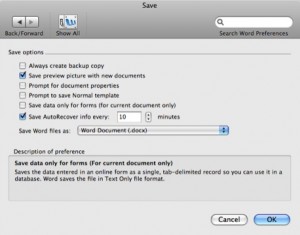
  • The first one being fairly useless and called “Always create a backup copy” which as the name says only create a “Backup Copy of <your_document_name>” file for every document you created.
  • The second one being “Save AutoRecovery info every:”. This option allows Microsoft Word to recover a file after a crash.

Everything seems to be in order, except that now we don’t have a protection against the user who quit Word without saving his whole day work (Yes it can happen, believe me).

Word Backup

Having recognized the problem and noticed that there is no “ready-to-use” solution, I decided to create a palliative solution. The provided piece of software reintroduces the old behavior of Word 5 with the newest version of it. An additional benefit of this script, when run on Mac OS X 10.5 or 10.6, is that you not only have access to the latest backup version but also to the history of it thanks to Time Machine.

Download

WordBackup 1.0

WordBackup 1.1

[update]The new version provided, logs the saved documents’ name under /Library/Logs/WordBackup.log[/update]

Dump maps from your Garmin to your Mac

I recently bought for my parents a new automotive GPS: the Garmin nüvi 765T. It comes with pre-loaded maps (in my case western europe) and I naively thought that the same maps will be also available on your computer. Unfortunately this is not the case, that is, the maps you get on your GPS aren’t available on your computer. You neither have the choice to dump them from your device nor to download them freely from Garmin.

In two words:”It sucks”

But, as you know, the answer it’s not possible, forseen is not enought to prevent me from trying, and, this time, with success (yeah I’m not that masochist to report my failure).

The only drawback is that currently the generated map is not “searchable”, that is, you cannot enter an address and have it displayed on your map.

Prerequisite

Windows side: dump (adapted from sorcieremonique’s forum)

  1. Create a temporary directory (for example C:/temp/garmin)
  2. Run the Free cGPSmapper installer (FreeSetup.exe)
  3. Move the cgpsmapper.exe and sendg.dll to the temporary directory
  4. Extract the content of wgmaptool040.zip to the temporary directory
  5. Extract the content of MapSetToolKit_v1.50.zip to the temporary directory
  6. Connect your Garmin to your computer with the USB cable
  7. Copy the gmapprom.img file from you GPS (located in the Garmin directory) to your temporary directory
  8. Wait as this might take a long time, in my case the file is 1,52 Gb in size
  9. Start GMapTool.exe:
    • Files tab: choose the gmapprom.img file you copied in step 7
    • Options tab: set correctly the path to cgpsmapper.exe
    • Split tab: choose an ouput directory (in my case C:/temp/CNEURONT2009), select create “files for MapSource”, check “Compile preview map”” and click the “Split all” button
  10. Wait as this might take a long time. You end up with a directory containt a lot of .img file
  11. Start MapSetToolKit.exe
    • Check the “install in Mapsource” checkbox
    • Click the install button. A new window appears
    • Set the path to the TDB file (in my case C:\temp\CNEURONT2009\mapset00.tdb)
    • Set the path to the Overview map (in my case C:\temp\CNEURONT2009\mapset00.img)
    • Set the path to the TYP files (in my case C:\temp\CNEURONT2009\I000017A.typ)
    • Fill the Registry name field with a sensible name
    • Click the install button

Windows side: convert

  1. Install Garmin MapSource software (as the only download provided is only valid for update you have to trick the installer as follow)
    • Install WinRAR
    • Unrar the content of MapSource_6141.exe
    • Run the MAIN.msi from the extract directory
    • Start the Setup.exe and install the software normally
  2. Start MapSource
  3. In Menu “Utilities” open “Manage Map Product”
  4. In the newly opened window go to tab “Unlock Regions” and click “Add”
  5. In the Garmin website, navigate to “myGarmin” and enter you login and password
  6. Navigate to the “myMaps”, “Manage Maps” and select you device in the drop down list if necessary
  7. In the section “Maps installed on this device” you should find your “Unlock Code”. Jot it down
  8. Back to MapSource copy the unlock code in the first field and click ok
  9. Start MapConverter, click “Next” till you get to the point where you can chose the map you want to convert. Select the one you want to convert and click “Next”. Choose a destination and click “Next”. If you don’t have space problem choose “No” for the compression and click “Next”. Wait for the conversion to finish.
  10. Copy the .gmapi file to your Macintosh

Macintosh side: install

  1. Double click the .gmapi file that you copied from Windows, this opens the Garmin MapManager
  2. Click the “Install” button and when finished “Quit”
  3. Start Garmin RoadTrip, in the upper right corner of the window you shoud now be able to select the newly imported map.

Tour du Mont Blanc

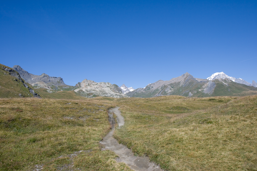
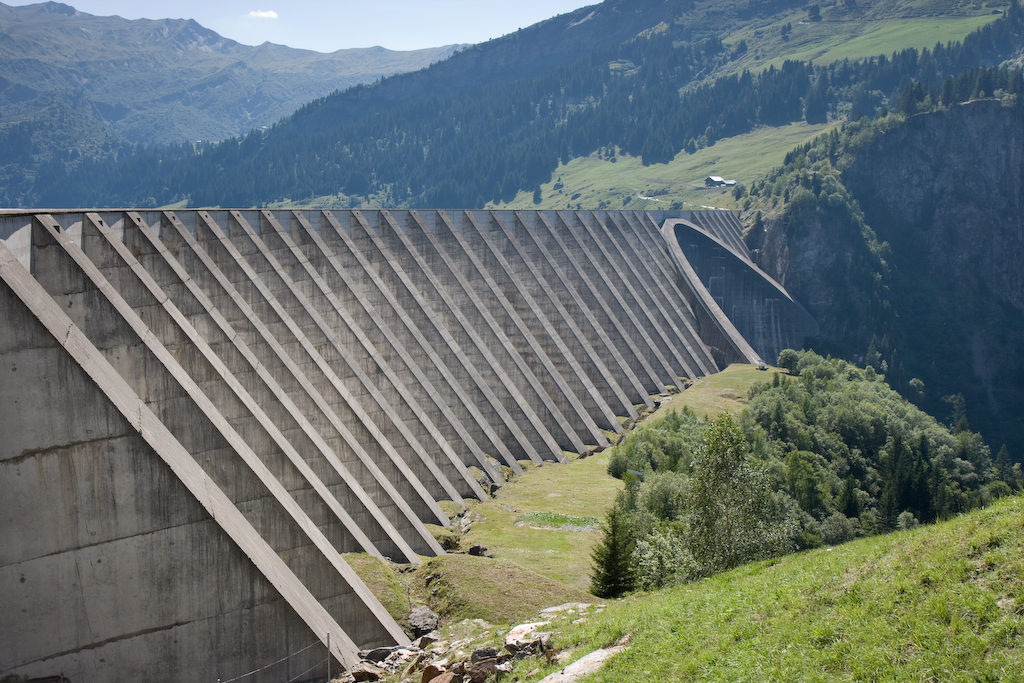
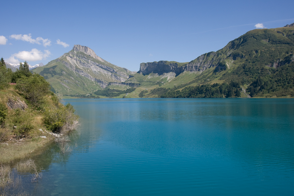
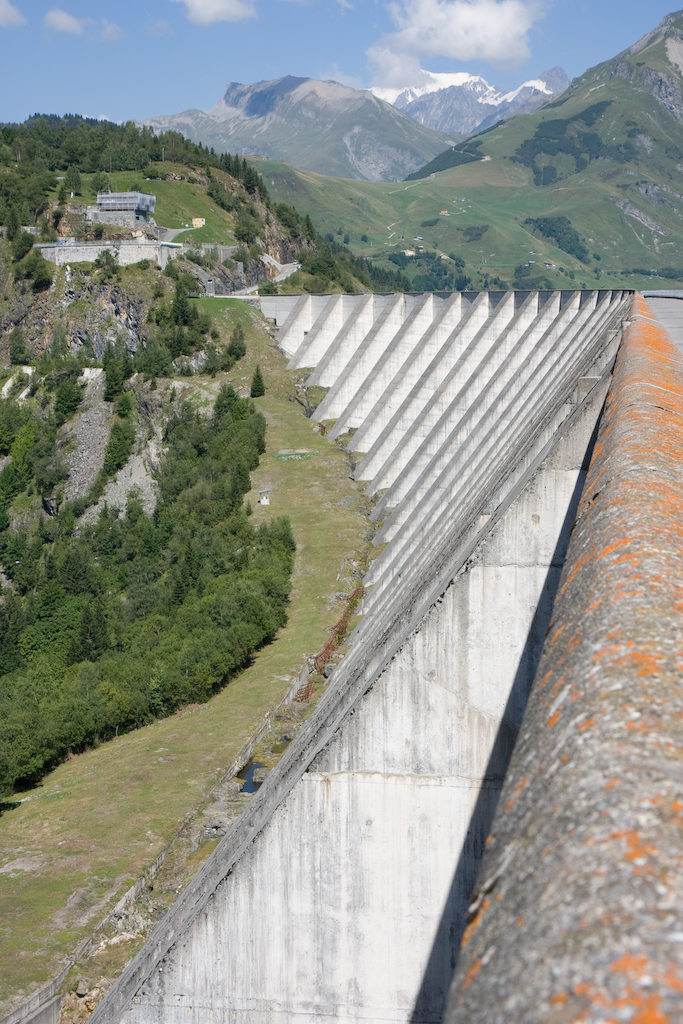
En ce dernier samedi du mois d’août, je suis sorti pour ce qui est, vraisemblablement, une des dernières grandes ballades de cette saison 2008. Comme le barrage du Roselend m’avait laissé un très bon souvenir, j’ai arrangé un parcours permettant d’y repasser.

L’itinéraire:

  • Genève
  • Cluses
  • Chamonix
  • Col des Montets
  • Col de la Forclaz
  • Martigny
  • Orsière
  • Liddes
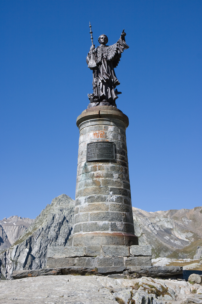
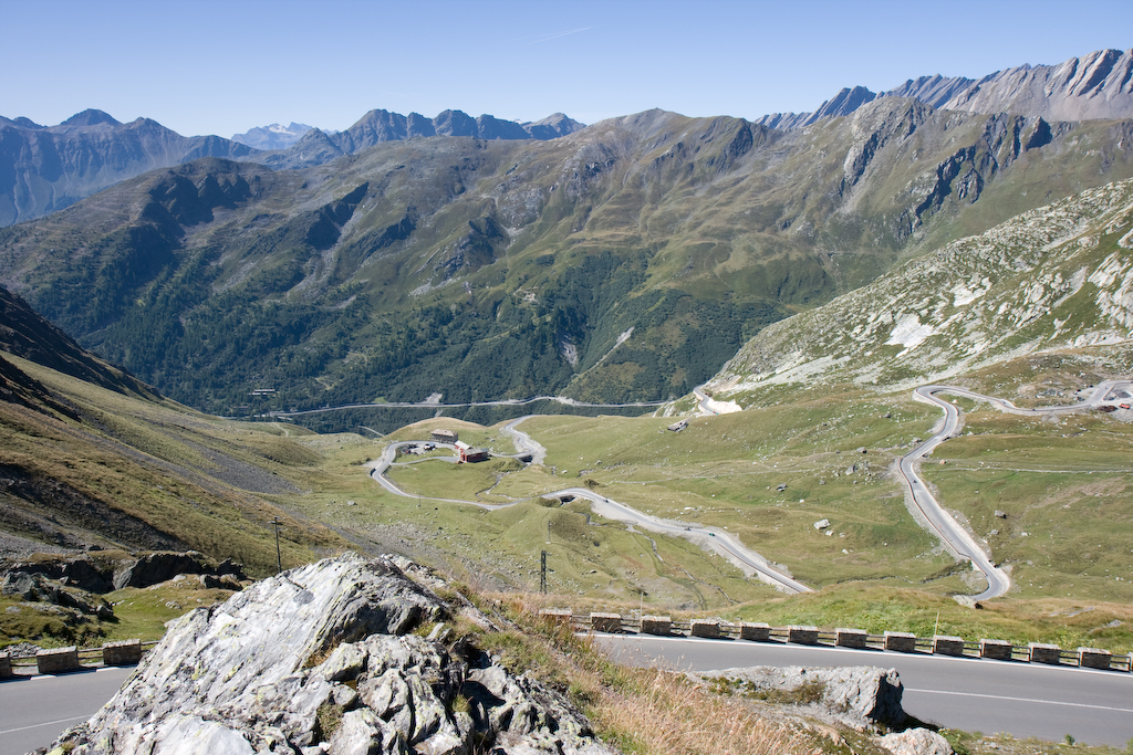
  • Col du grand Saint Bernard
  • Aoste
  • Pré Saint Didier
  • Col du petit Saint Bernard
  • Bourg Saint Maurice
  • Cormet de Roselend
  • Beaufort
  • Col des Saisies
  • Col des Aravis
  • Le Petit Bornand
  • Genève

Au total 446 Km de jolies routes tout autours du Mont-Blanc.

Je recommande particulière la descente du grand Saint Bernard, côté italien, pas tellement pour la route mais pour le paysage qui rappelle brusquement que l’on est passé au sud des Alpes (je pense en l’occurrence à la superbe forêt de mélèzes à la couleur vert tendre). Attention il est cependant impératif de passer par le col et non par le tunnel pour emprunter cette partie du parcours.

Le Cormet de Roselend est toujours aussi incroyable, de plus cette fois ci je me suis permis de faire un petit détours pour aller voir le barrage de plus près.

Test du Navibus de la CGN

En cette journée orageuse du mois d’août, j’ai enfin réalisé un test que je désirai faire depuis longtemps: Je suis allé faire un tour sur le Lac avec le nouveau bateau de la CGN.

Il s’agit donc d’une bateau appartenant à la Compagnie Générale de Navigation sur le lac Léman (CGN) dont les spécifications se trouvent ici.

Comme indiqué par la puissance des deux moteurs, ce bateau va vite (50km/h) et accélère fort. Il n’est pas vraiment plus bruyant qu’un autre, mais peut être un peu moins confortable de par le fait que même les petits changements de direction se font assez facilement sentir (il n’y a pas de progressivité mais plutot des à coups). Ceci dit l’entrée en service de ce bateau permet de relier Nyon à Genève et ce avec un arrêt a Chens-sur-Léman en moins de 45 minutes (selon mon expérience, et en 45 minutes selon l’horaires).

Si vous avez l’occasion de passer sur les rives du Léman, je ne peux que vous recommender de faire un tour avec ce bateau (il est marqué spécialement dans les horaires) qui offre l’avantage d’être nettement moins remplis que les bateaux belle époque pendant la période estivale.